Category Archives: Woolston

Virtual Tour of the Solent ~ The Story so far and where to next?

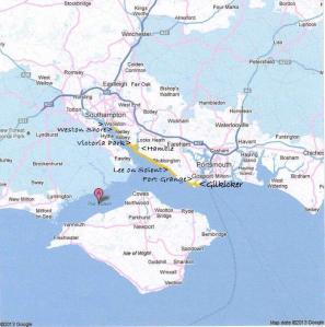
Solent map googleCalshot

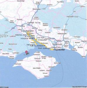
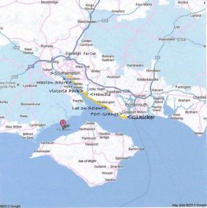
I began this virtual tour to show that a sense of place is important in my writing. I need to describe the areas in my novel enough to help the reader to feel that ‘sense of place,’ but I thought it might be helpful to give a little more background information and description. I have written ten posts around the Solent area so far, but before I leave the shores of mainland England I thought a summary would be helpful:

1 ~ At the beginning of this year I began my virtual tour at Gilkicker Fort on the strategic peninsula guarding the entrance to Portsmouth Harbour. It was there that one of my main characters, Harriet’s daughter Sarah, was stationed  with the husband, at the newly refurbished married quarters, back in 1910. It was a life that Sarah found hard to come to terms with but then came the war which changed everything.

2 ~ Close by was Fort Grange, still enclosed in the Naval Station today, where early pilots were trained for combat and reconnaissance missions in WW1 including Anthony, Sarah’s husband.

3 ~ A short distance along the coast is Lee on Solent, not strictly speaking in Ancasta Guide me Swiftly Home, but it may be in the no, 3 in the series. Lee was important at that time though, since it was one of the earliest Flying Boat Stations on the south coast.

4 ~ Just up the estuary takes you to the sheltered inlet into Hamble, which is an unspoilt haven for sailing boats. Anthony’s family lived there, with its cobbled streets and a small ferry over to Warsash, much the same today as it was at the turn of the last century, I should imagine.

5 ~ Further up Southampton Water is The Royal Victoria Park, once the Royal Victoria Hospital at Netley, with only the tall chapel remaining as a signal to the grandeur of the original building which had corridors a quarter of a mile long. It is still a lovely place to visit, go for a stroll, have a picnic and find out about its interesting history. Jane, one of my characters, well known to those who have read Riduna, was stationed there, close enough to Harriet for them to remain friends although Jane had little time to spare for social calls, especially during the war.

6 ~ Visiting the ghostly remains of Netley Abbey en-route, popular with the Victorians, we reach Weston Shore, important in both of my novels as a place to feel the sea and watch those on their journeys too and from Southampton Docks. It could be a place you might overlook, but if you make the efffort and stop and have a walk along its shores, it’s a haven for wildlife and it’s a wonderful place to watch the world go by. It’s here that the name of my novel seemed so apt. ‘Ancasta’ ~ ‘The Swift One.’ Many folks have stood, as Harriet did, on these shores and prayed for the swift and safe return of their loved ones, but for Harriet it was more than that. It was here she watched the Channel Island Ferries as they journeyed to the place of her birth. It was a direct channel to Guernsey (Sarnia in my novel) and Alderney (Riduna in my novel) which she loved but had left behind so long ago.

7 ~ Woolston. The Newton family grew up in the heart of Woolston, working in the local industry, initially as boat builders but subsequently early flying boats. (Supermarine) Harriet ran a popular guest house mainly for travellers. One of her son’s worked in a bicycle shop too. Each of her family played their part in WW1, Sarah returning home for the duration of the war with her little son Timothy.

8~ Southampton. Across the Floating Bridge is Southampton itself, still a thriving port and the window to the world to many of my characters including Edward, also well known to many of you from Riduna, Harriet’s childhood sweetheart from the island of Riduna. Their lives took very different paths but they continue to cross at times and Edward’s occasional visits still have a positive impact on the lives of the Newton family, especially Timothy and Sarah.

9~ Over the Hotspur to Hythe is where Edward lives, when he’s on land, with his more than housekeeper Marie. She’s a larger than life character and I’m quite fond of her, even though I feel a bit disloyal to Harriet for doing so.

10 ~ Just a few miles up to the peninsula we reach Cashot, at the mouth of Southampton Water, and if you want a place to ‘ship watch’ this is it. One of Harriet’s son’s Jack was stationed here before and at the start of WW1, where he was an engineer at the new RNAS flying boat station back in 1913.  He continued to travel home to his young family in Woolston, that was until he joined up and travelled to join the HMS Ben my Chree, one of the earliest sea plane carriers which went out to Turkey.

So, where does my virtual tour go to next? We reach the point when we now travel beyond the Solent, and we’re heading across the sea to The Channel Islands as from Monday. In fact that’s where the original story  of Riduna began.

Meanwhile I’m continuing my real centenary tour

at Waterstones in St Neots this Saturday on 23rd March from 11am.

I look forward to meeting some more of you then.
2 Comments

Filed under Alderney, Ancasta, Early Flight, Events, Flying Boats and Sea Planes, Riduna, Southampton, Virtual Tour of the Solent and Beyond, Weston Shore, Woolston

The Solent Area ~ Virtual Tour no 8 ~ Southampton

Solent map googleSouthampton

In the past, if  you’d taken the Floating Bridge over the River Itchen from Woolston then you would be close to Southampton Docks and as a child, when holidaying with my Grandma we used to do the round trip… over to Southampton via the Floating Bridge and back via Northam Bridge, or the other way around if that bus came first at the end of Newtown Road. A lady at my book launch at Woolston Library reminisced,

‘Wasn’t it irritating,’ she said, ‘that the bus always used to leave just as the Floating Bridge reached the shore!’ We all laughed sharing her memory.

Did you know that the Channel Island ferries used to leave from the docks at what we know as Ocean Village today, back in the nineteenth century?

To present old Southampton I am going to share with you another selection of Grandpa’s postcards, dated in the Edwardian era in the early years of the twentieth century. I can find no identical postcards on the internet and believe they do not hold any copyright due to their age.

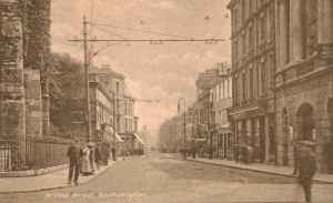
Leaving the Floating Bridge we will first walk up Bridge Street where you can see the tram tracks:

Bridge Street

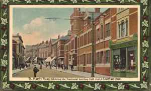
Then we will head north to St Mary’s Road:

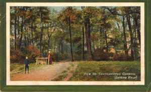
St Marys StreetFurther north of the city to Southampton Common and Lover’s Walk:

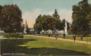
The Common Lover's WalkAlthough the walk to the common would be quite a long one in today’s terms, the people of those days thought nothing of such a walk on their half day off, to snatch moments with their loved ones and enjoy the fresh air. The Common saw famous air displays at that time too. If walking to the common was out of the question then Southampton also enjoyed Palmerstone Park close to the City centre:

Palmerstone Park

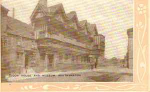
Now we are back in the city, Tudor House museum has changed little and has recently been renovated. It is pleasant to have a stroll along the quieter back streets along the top of the wall:

Tudor House

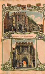
Out Grandfather had a shop near to the Bargate not far away, before they knocked part of the wall down for the tram route.

Bargate

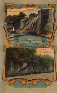
Taking what my sister and i used to call the thirty nine steps when we were small you can walk down the wall. The shots below are still recogniseable although in front there is now a car-park and the West Quay Shopping Centre. This fascinating shot shows before and after the reclamation of the land to build the modern day docks, the first part of which was opened in 1842:

The wall

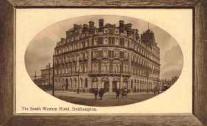
Following the wall along we are back down at the harbour and here is the South Western Hotel, recently converted into luxury flats and you can still see the structure of the docks railway station behind it although the busy streets in front take a while to cross, unlike the picture below:

Western Hotel

And finally here is another ‘then and now’ postcard which shares so much of history with us in a snapshot, but of course the ‘now’ in this postcard is over 100 years ago!

The docksAs one of the ladies on my last post of less common postcards of Old Woolston commented, these are a wonderful resource for research and ideas for writing. For me they are more than that. It’s just a pleasure to browse and wonder at the stories they tell and see places where my family lived and worked, but were also inspired enough to leave a trail behind.

Leave a comment

Filed under Family History, Research, Southampton, Virtual Tour of the Solent and Beyond, Woolston

The Solent Area Virtual Tour no 7 ~ Woolston and Itchen Village

Solent map googleWoolston

Today I am going to share with you a snapshot of old Wooston through copies of my Grandfather’s book of postcards. They are not dated, but looking at postcards of a similar era I would certainly say they were Edwardian.

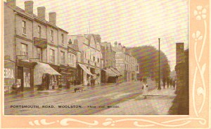
Portsmouth Road Woolston Southampton

Portsmouth Road Woolston Southampton

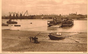
Above is the Portsmouth Road on its way down towards the Floating Bridge, and below is the Floating Bridge looking over towards Southampton:

The Floating Bridge Woolston

The Floating Bridge Woolston

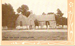
Then, travelling up the road to the outskirts of Itchen is Pear Tree Green church, not changed much today and still on the green overlooking the River Itchen:

Pear Tree Green Church

Pear Tree Green Church

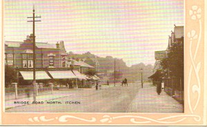
Still on the Itchen side of the Portsmouth Road is Bridge Road. The little of it left today is under the new bridge:

Bridge Road

Bridge Road

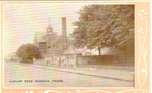
Many locals will remember or recognise Ludlow School, still on the Itchen side of the Portsmouth Road although many called it Woolston:

Ludlow School Itchen (Woolston)

Ludlow School Itchen (Woolston)

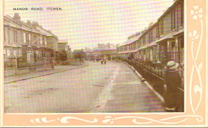
Here we have Manor Road. Many of these streets in and around Woolston look much the same today:

Manor Road.tif

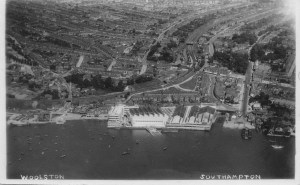
Now we move much later and here is an ariel photo of the Supermarine Works in Woolston which I date in the 1930’s. It was bombed and flattened in 1940.

Supermarine Woolston

Supermarine Woolston

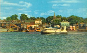
Finally one of my own postcards from the 1960’s of the hovercraft which ran from just over the river to the Isle of Wight:

Hovercraft to Isle of Wight

….and so what are Woolston and Itchen Village famous for, apart from being the location from which my second novel Ancasta Guide me Swiftly Home flows.

Firstly there’s Supermarine, initially famous for winning Great Britain the Schneider Trophy back in 1931. It was first opened and the name ‘Supermarine’ emblazoned on its roof 100 years ago in 1913. (even though the company was not registered officially under that name until 1916.) Famous in those days for its flying boats and then its sea planes, it must have been a wonderful site, watching them glide along towards Southampton Water and take off. Of course, most people know Supermarine for the Spitfire and it was here that RJ Mitchell developed the first prototype, which my father was lucky enough to see on its inaugural flight.

Even before Supermarine there was Thornycroft, whose land on the banks of the river has finally been made safe, flattened and is being redeveloped. Wikipedia says that the yard launched over 100 ships between 1876 and 1889 alone!

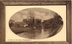
I am going to leave you with a lovely old photo of the River Itchen. Is this the mill at Swaythling just up the river in 1910 or in the late nineteenth century? I can find no photo which looks exactly like this but I’d love to know.

Mill Ichen river.tif

4 Comments

Filed under Ancasta, Schneider Trophy, Southampton, Supermarine, Virtual Tour of the Solent and Beyond, Woolston